
New Albany Previous Resident Sources
No single source spans every period or proves every occupant. Start with the date being studied, then choose records that can distinguish title from residence. Floyd County's deed image claim reaches farthest back, while city directories, census schedules, permits, images, and death-era records answer narrower questions.
| Source | Years It Covers | Where Held | What It Shows |
|---|---|---|---|
| Recorder deed images | 1783 to current, with gaps | Tapestry, Laredo, Recorder office | Parties, legal description, title links, liens and plats |
| City directories | Listed runs, 1845 to 1929-30 | Floyd County Library, Internet Archive, State Library | Dated names, work, home and business addresses |
| Federal census | Decennial through 1950 under the current release rule | National Archives and library databases | Household, age, relationship, work, and census-date residence |
| Historic permits | 1890-92 inventory item | Floyd County Historical Society | A lead to work recorded at a property |
| Historic Homes images | New Albany examples from 1969-75 | Online street index and IU Southeast archive | Exterior, listed address, and image year |
| Fairview burial books | Digitized volumes, 1852-1949 | Floyd County Library | A name and dated burial-era endpoint |
For a recent transfer, begin with today's parcel and deed. For a nineteenth-century household, pair the closest directory issue with census, land, newspaper, and cemetery material. A source missing from the web may still exist in an original book, microfilm run, vertical file, or finding aid.
Start New Albany Address History
Capture today's parcel before moving backward. Save the situs address, parcel and alternate IDs, deed holder, mailing address, legal description, lot or subdivision, and deed reference from Beacon or GIS. The situs is the physical site. The mailing address is where tax notices go. Neither one alone proves who lives in the building.
Use adjacent parcel shapes and plats to test continuity. Lots can split, combine, or move into a trust or estate. The Floyd County map is reference data rather than a legal survey. When an online viewer lacks the needed detail, free terminals at the Downtown and Galena library branches and at City-County Building offices provide another channel.
Trace Floyd County Deeds Backward
The Floyd County Recorder preserves the ownership trail. A chain of title is the linked series of recorded transfers for the same land. Keep the legal description beside the name at every step. A matching surname is weak evidence if the lot, subdivision, book reference, or parcel does not also match.
- Search the current deed holder as grantee, including estate, trust, entity, and spelling variants. Open or request the purchase deed.
- Record the parties, recording date, document number or book and page, legal description, restrictions, easements, and prior reference.
- Search that deed's seller as an earlier grantee. Limit the date range and check the same land description before accepting the result.
- Repeat the grantor-to-earlier-grantee turn. Use
DB00Afor 1818-53 books,DB001throughDB216for 1853-1974,MI001for miscellaneous material, and year-drawer formats for 1974-99. - Take illegible, deferred, split-lot, or missing items to the Recorder or Surveyor. Preserve the break until an original book or plat resolves it.
- Grantor and grantee
- The grantor transfers an interest; the grantee receives it. To move back, search a seller as the buyer in an earlier deed.
- Chain of title
- The sequence of transfers tied to the same land, checked deed by deed.
- Legal description
- The deed's land identity, often a lot, block, subdivision, grant, or measured boundary. It survives changes in street numbering better than an address.
Reach New Albany's Deed Index
The Recorder advertises indexed images from 1783 to current, with illegible or deferred exceptions. Tapestry is pay-as-you-go at $8.95 per search plus $1 per printed page. Laredo subscriptions range from $30 for up to 100 monthly minutes to $300 for unlimited minutes, with other copy or overage charges. Setup goes through the Recorder at 812-948-5430.
Laredo's local guide advises users to omit punctuation and ignore case. Its document formats change by era, so the guide is especially useful when a modern address never appears in an old index. The office at 311 Hauss Square, Room 115, is open Monday through Friday from 8 a.m. to 4 p.m. and can help with an original book, though staff do not conduct a title search or prepare a deed.
New Albany's Territorial Lot Bridge
The Clark and Illinois Grant book covers 1783-1850 and points to the New Albany city plan as CG00A-137A. Its descriptions may use “town of New Albany No.” or an out-lot letter on a named street. Because that land first fell under Clark or Harrison County jurisdiction, the material is historical and not certifiable as a Floyd County record.
That limit does not erase its value. Floyd County was formed in 1819, after the city's 1813 plat. The grant entry can link an early lot description to later deed books when no street number exists. The 33-foot survey chain preserved by the local historical society also explains how the first streets and lots were laid out. Treat both as route markers, not proof of a current ownership line.
Research New Albany Previous Residents
The Floyd County Library's Indiana History Room directs house research to deeds, Historic New Albany, Historic Homes, federal land patents, Sanborn fire-insurance maps, vertical files, newspapers, and local collections. Staff recommend appointments. Remote article or obituary work is limited to four requests per month after an index search, and vertical-file digital copies share a four-request monthly limit.
The library house-history links show these paths in one place.
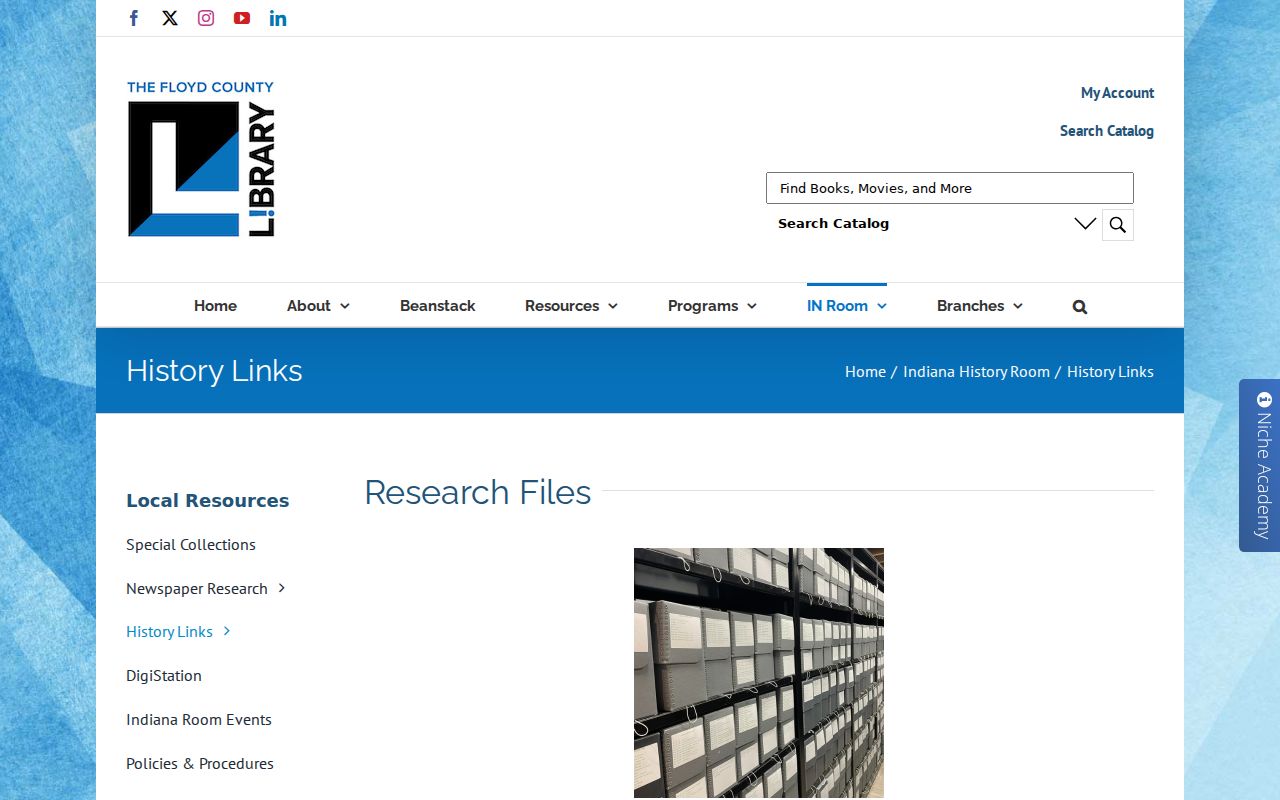
The captured library page is the fallback when a parcel trail reaches photos, maps, clippings, or sources that were never indexed as modern deeds.
Keep New Albany Addresses Aligned
Early directories describe Water, Main, Market, Spring, State, Lower and Upper numbered streets, wards, corners, sides, “between,” and “near.” Historic Homes uses address and street pages for examples dated from 1969 through 1975. Sanborn maps can add a building footprint, material, use, firewall, and number for a specific map year. Each helps connect an old phrase to a parcel, but none replaces the deed.
No official citywide street renaming or renumbering schedule was found. Do not interpret a changed number as a move without checking a legal description, old plat, map, newspaper landmark, and adjacent addresses. This restraint is vital when searching previous residents because a false address match can send the entire household trail to the wrong building.
New Albany Homes in Dated Images
The Historic Homes Digital Library acts as a reverse address archive, not a deed index. New Albany examples include 1739 Market photographed in 1973, 1929 Market in 1969, and 1500 Elm in 1969, with many Market and Spring entries dated from 1969 through 1975. An exterior and listed address can test whether a number or building form stayed consistent before a later permit or transfer.
Always retain the image year. The archive does not show a complete title chain, prove occupancy on the date pictured, or establish that today's parcel has the same bounds. If a street page fails online, ask IU Southeast Special Collections or the Indiana History Room about the underlying archive.
Pair New Albany Household Records
Owners are only one part of an address story. A city directory may name a person, occupation, business place, and home address in its publication year. A federal census can show a household, relationships, ages, work, and residence on its census date. Neither should be stretched beyond that date. The library's listed directory run begins in 1845 and ends with 1929-30, while the latest public census is 1950 under the current 72-year release rule.
- Search the closest directory issue by surname and then inspect its street section. Normalize abbreviations and directional words.
- Write down the exact name, work, home, ward, corner, or “near” wording. Check the scan because OCR can alter short terms.
- Compare the nearest census year. Use age, household ties, occupation, and neighbors to separate people with the same name.
- Test the address against the parcel, deed, plat, and map. An occupant may have boarded there or used it only for business.
- Repeat before and after the target year, leaving a gap when no issue survives or no match is firm.
The collections and publishers are covered more fully on the New Albany city directory page. Here, they serve the backward trail for one address.
Lawful use. Research past residents for family history, property history, estates, and personal curiosity. Never use a record trail to harass, track, or harm a living person.
Close a New Albany Resident Trail
An obituary can identify relatives and a last address. Probate may name heirs, an estate, filings, or a transfer. A final deed may show an estate or trust. Fairview's digitized burial books, divided into volumes from 1852 through 1949, can supply a dated endpoint, though the archive is not one live query.
The library newspaper research page links the New Albany index for 1849-1889, broader archives, microfilm, and the remote request route.

The image shows the newspaper access channel that can explain a disappearance from a directory without assuming a move. Search notices by name, address, relatives, business, and a narrow date range.
Fairview is another local endpoint. Its history includes an 1891 renaming and burial context tied to the 1844 Lucy Walker disaster. Choose the volume that covers the likely date before reading the scan.
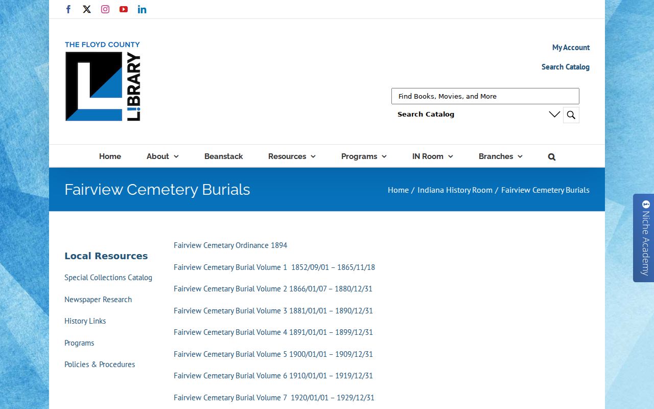
The dated-volume structure prevents a missing search box from being mistaken for missing records. Compare any burial clue with an obituary, probate file, and deed rather than relying on one name.